Location, location, revisited
Previously on Status-Q...
Regular readers may remember that a couple of months ago, I lost my glasses and found them again. If you missed that particularly gripping episode, turn back to Location, location, location (or, 'How technology saved me a few hundred quid yesterday') and then you'll understand the background here.
After posting it, my friend Phil Endecott got in touch with me. "Am I to understand", he said, "that you would find it useful if you had a map app that could show both the locations of your photos and your current location at the same time? If so, I may have just what you need...."
And he did indeed. Phil, you see, is the author of UK Map, an iOS app that I've had for as long as I can remember, and one I should talk about more, because I use it all the time, especially when looking for new dog-walking routes. Yes, I may use Google Maps to find out how long it'll take me to drive there, and Streetview to check that there's likely to be a parking spot when I get there, but once I've laced up my walking boots, then I generally switch to UK Map. It combines free or paid-for Ordnance Survey maps with footpaths from Open Street Map, and, certainly round here, it's a much better guide than almost anything else as to where you can actually go for a walk.
New features get added periodically and, like much of the cool stuff, are often buried deep in some menu below some unassuming icon in the corner, making them very easy to miss, so you really do want to go to the home page and read it carefully to see what the app can do, and then to the help button in the app to see how to do it. I don't check these often enough, but when Phil's message prompted me, I had another explore and found that, yes, it can show your photos on your maps. This is the site of my aforementioned adventure:
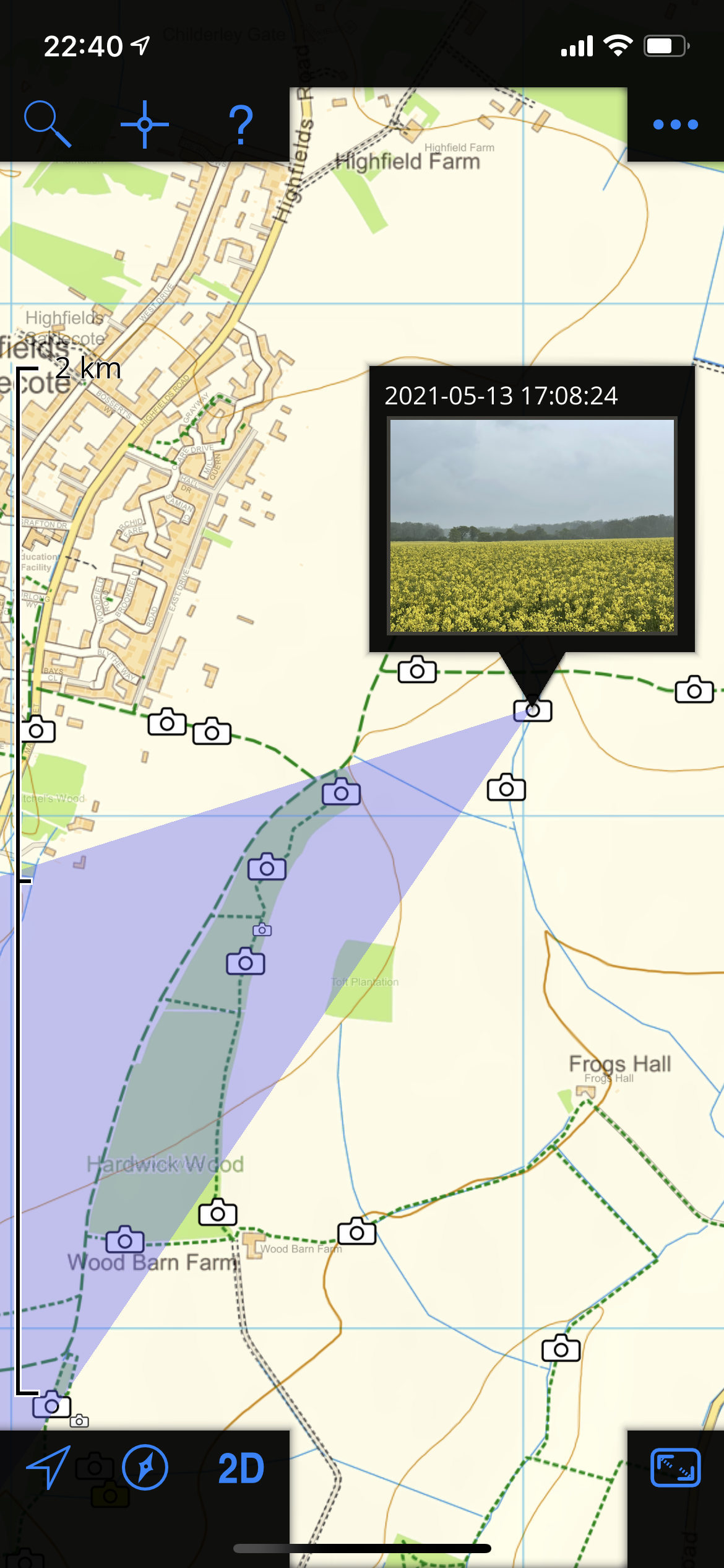
and if I had been there at the time of writing this, the little blue dot would indeed have shown me exactly what I needed to know. (The violet-coloured triangle there, by the way, is showing the rough direction in which the phone was pointing when it took the picture, and therefore shows what you may be able to see in it. Neat, eh?)
Anyway, I've mentioned UK Map before, but I've used it for so many years that I take it for granted. I do think that if you put in a little time learning what it can do, you'll find it repays its very modest purchase price. Actually, it'll repay that even if, like me, you really only scratch the surface.
P.S. If you happen to be anywhere other than the UK, this will be of limited use, but if you're in North America, Phil is also the author of the highly-rated Topo Maps
Leave a Comment