Where the streets have many names

Here’s a pretty map of Chicago, produced by Erin Davis:

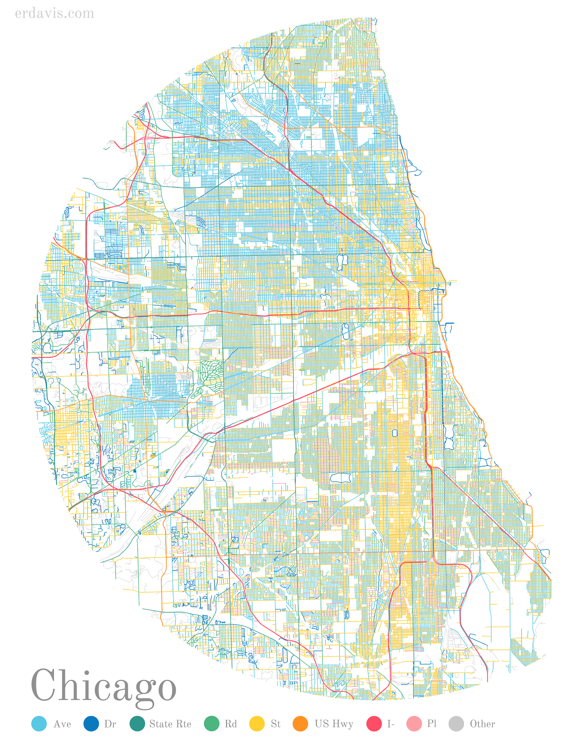
(Click for a larger image)

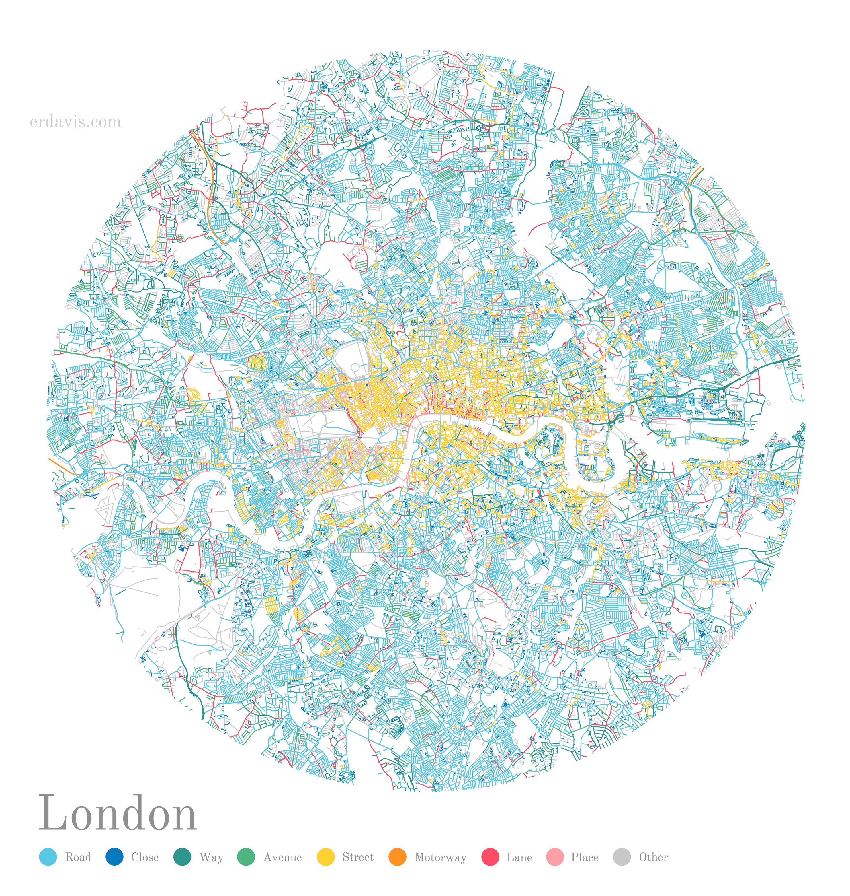
The colours come from the street suffixes: Green for ‘roads’, yellow for ‘streets’, etc. It’s an interesting commentary on naming trends and the historical development of the city.

Erin’s done many more, too, which you can find on her site here, and more recently including more global cities, here.

There clearly haven’t been many new ‘streets’ in London for some time…

Enjoyed this post? Why not sign up to receive Status-Q in your inbox?

Got Something To Say:

Your email address will not be published. Required fields are marked *

To create code blocks or other preformatted text, indent by four spaces:

    This will be displayed in a monospaced font. The first four 
    spaces will be stripped off, but all other whitespace
    will be preserved.
    
    Markdown is turned off in code blocks:
     [This is not a link](http://example.com)

To create not a block, but an inline code span, use backticks:

Here is some inline `code`.

For more help see http://daringfireball.net/projects/markdown/syntax

*

© Copyright Quentin Stafford-Fraser